Mill Creek Ravine Trail Realignment - South 76 Avenue
Engagement has concluded
***The discussion has been concluded and the What We Heard Report is now available.***
*Additional project update and supplementary documents can also be found in the Project Library section for your reference.*
Thank you for participating in engagement activities for the Mill Creek Ravine Trail Realignment.
-
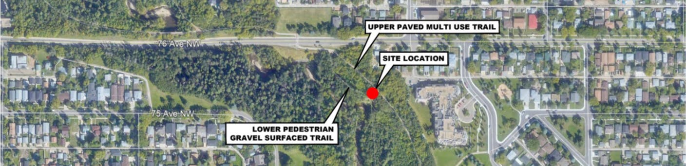
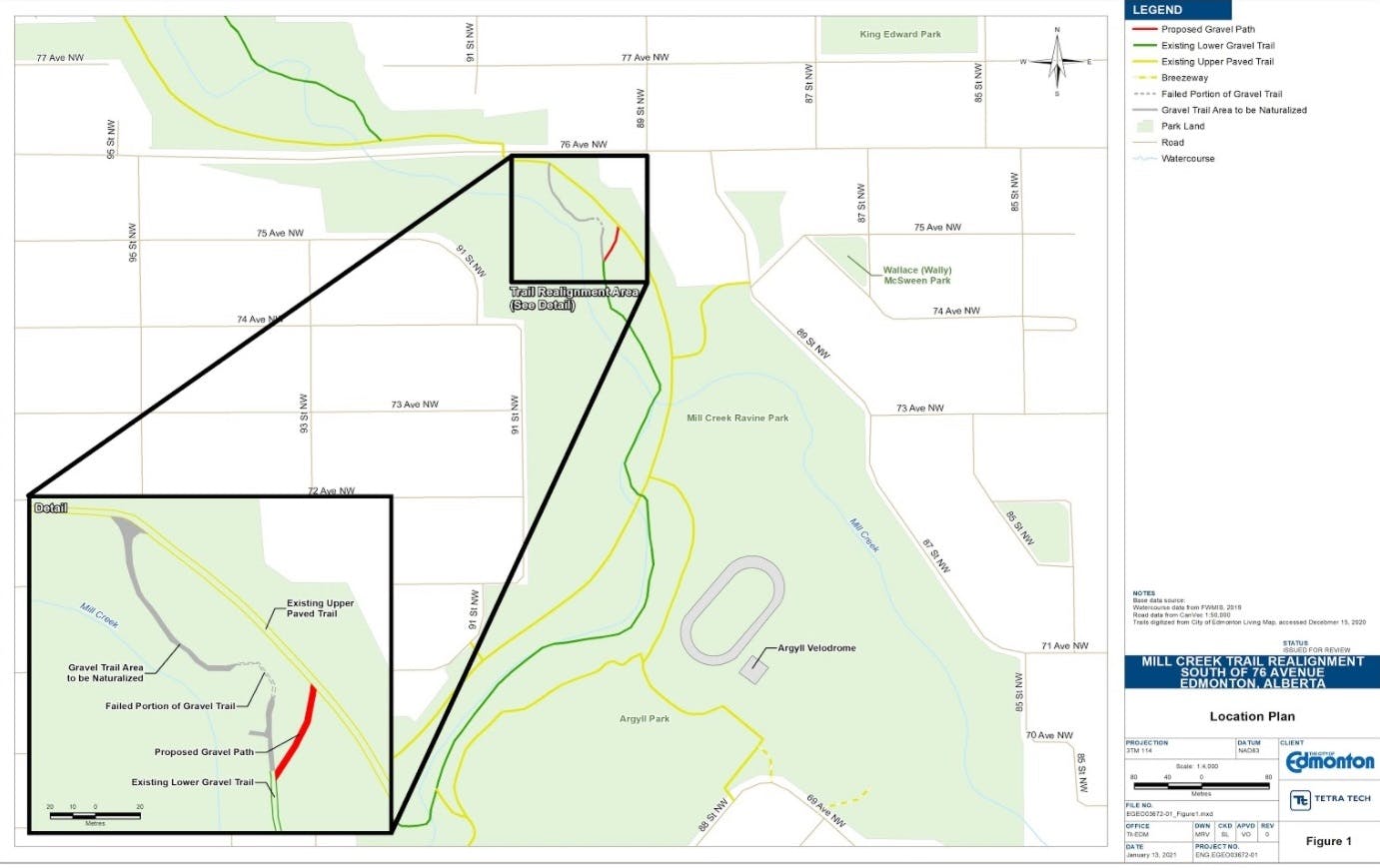
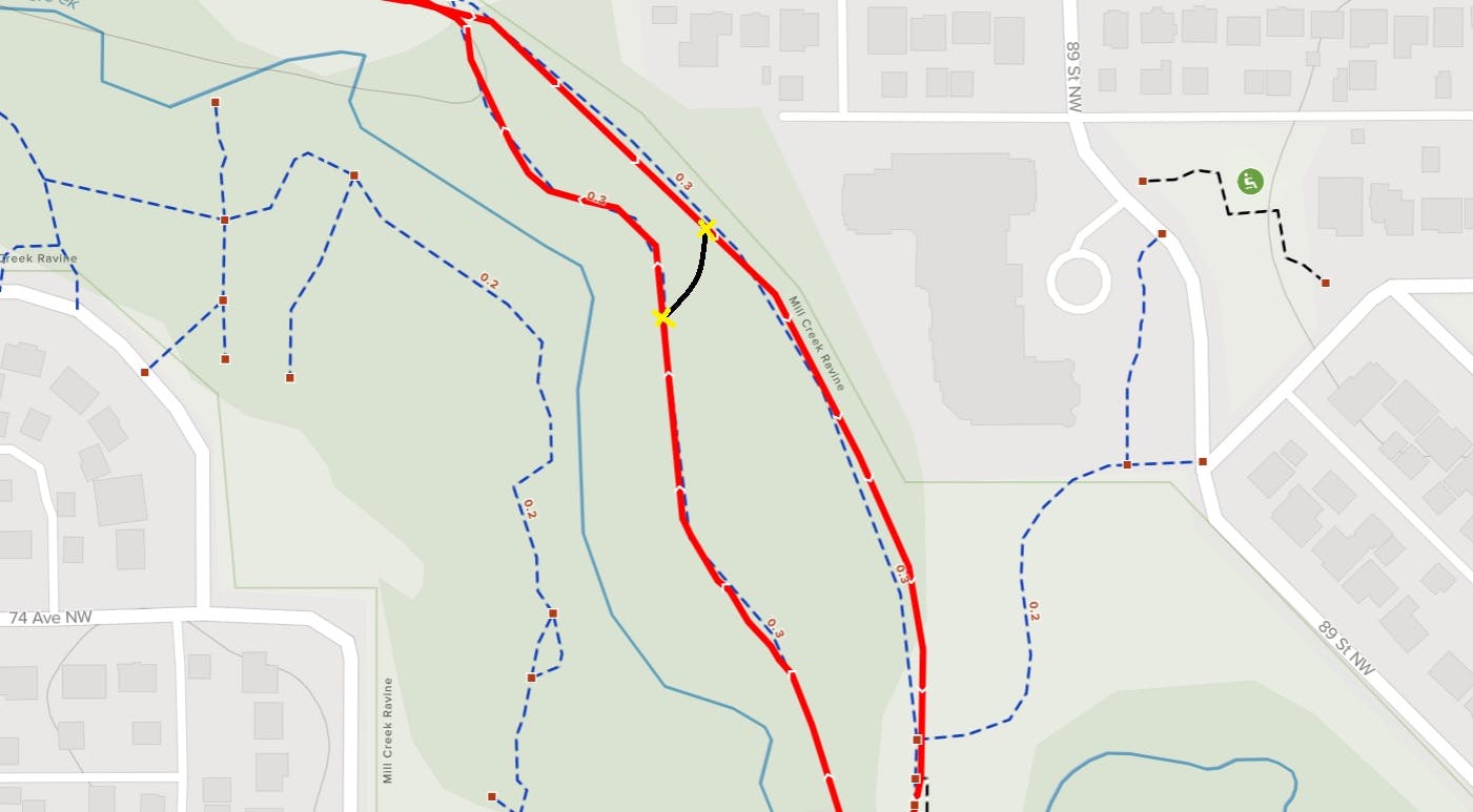
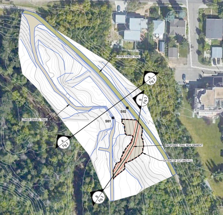
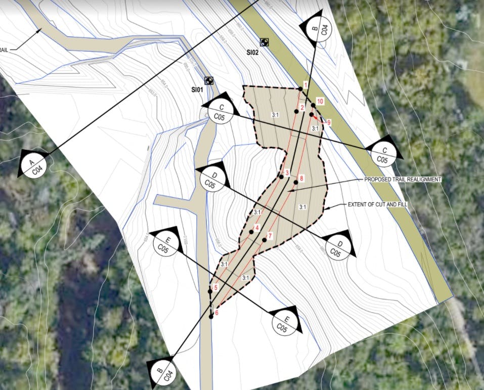
The Mill Creek Realignment Plan includes connecting two trails - a paved shared-use path located higher up in the ravine and a gravel trail below it. The lower trail has been closed to the public since Summer 2020.
Please review the trail realignment plan (Narrated Video Presentation or PDF slides), and share your feedback on the following questions:
View All Ideasabout 3 years ago
More options required
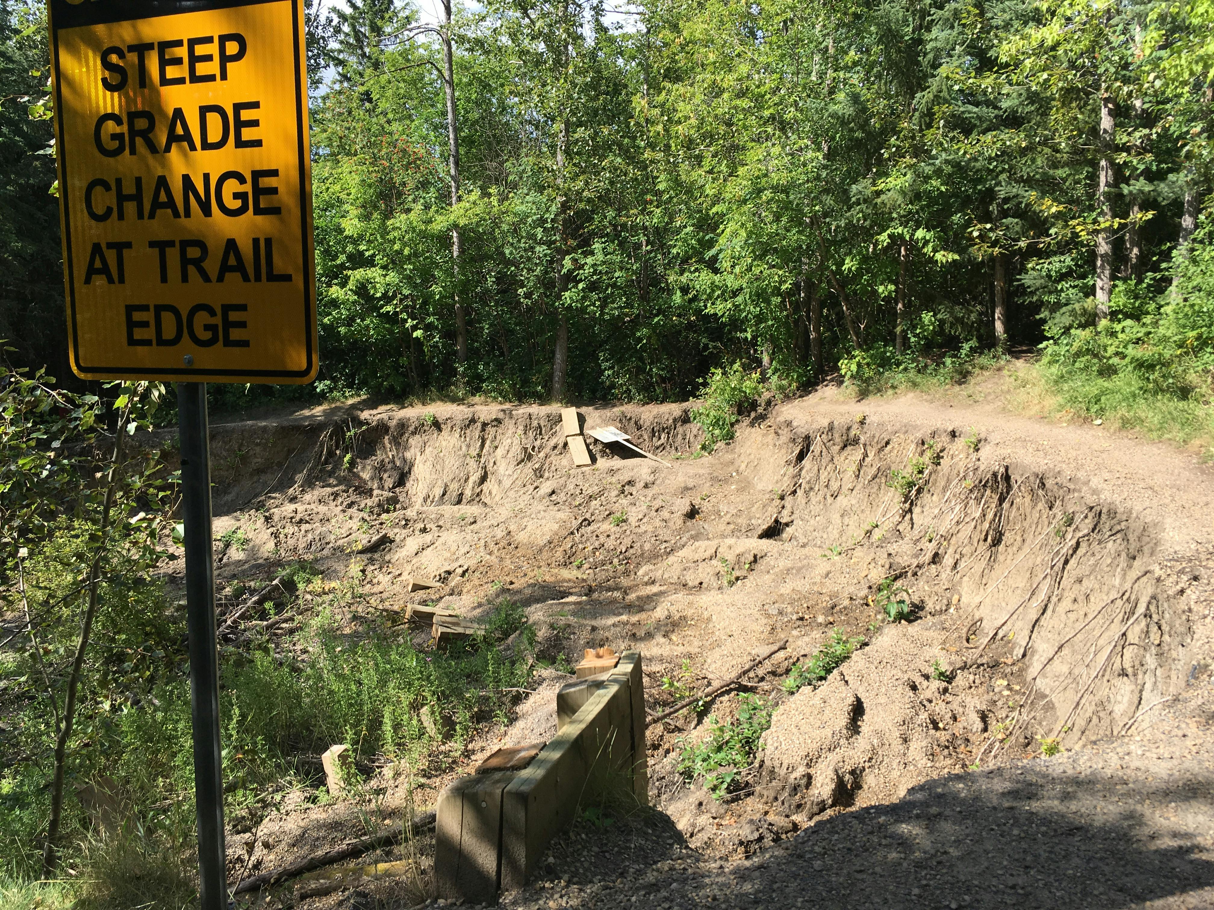
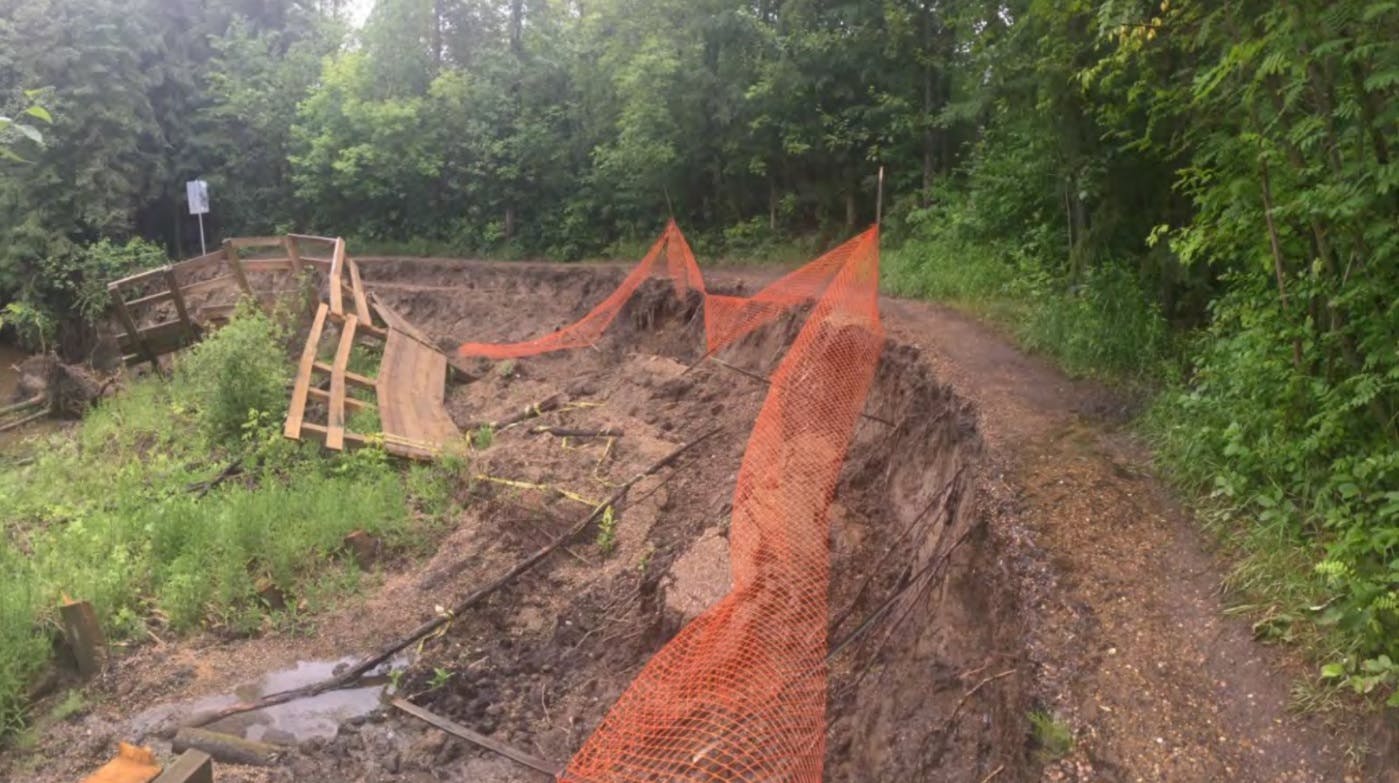
Either fix the trail or close it, but this new connection is not needed. A new retaining structure similar to what was there could be put in, but additional culvert/drainage structures would be required from the east (by the paved trail) to keep the water flowing under the new trail instead of washing it away. This trail erosion was purely due to high flow during an extremely heavy rain event. The water needs another way to get to the creek from uphill other than just over the trail.
over 3 years ago
The pathway has been wet for over 3 years now. Add drainage pipe to channel under and away from the area and replace pathway.
Area is very wet
about 3 years ago
ELEVATED HILL DECK / BOARDWALK / BIKE LANE
Instead of wasting this space, why not build an elevated hill deck/boardwalk/bike lane that could cover the area of where the erosion starts to where the water's edge is? The erosion would have to be properly reinforced, and there could be an access point to the deck/boardwalk/bike lane from the main paved trail. A deck/boardwalk/bike lane would also make great use of the pre-existing trail, and a designated lane on the deck/boardwalk/bike lane could allow the gravel trail's traffic to flow nicely. One could use this area as a resting point after a long walk, bike, or any other leisurely activity. The location receives a lot of sun hours and has the potential for a renewable energy project. This location is beautiful year-round and would be a nice place to relax and be with nature. I've frequently used this trail for 20 years since I could ride a bike. It would be a shame to see it be taken away. The attached pic would be great as a bare minimum...(I could send CAD files to the COE, if there are no ideas of how to utilize this space)
about 3 years ago
Naturalize the eroded area..
I was searching out how u can prevent the soil erosion..then I found this is also a good idea to prevent this from soil erosion.. Put down fiber logs. Another option for erosion control on steep slopes is a series of rolled up logs or "wattles" made from fibrous material (like straw). Water running down the slope will slow down when it hits the logs, soaking into the soil instead of carrying mud downhill. Put the logs down across the slope, 10 to 25 feet (3–8m) apart. Hold them in place with wooden stakes or sturdy, living plants. You can plant seeds directly in the logs to protect them while they grow. If you do plant seeds directly into the logs, you should still use stakes to hold the logs in place, at least until the seeds develop sturdy roots that go into the soil..Do something like this if its possible...Plzz save these Natural area...
about 3 years ago
I don't think I have any concerns. But I can't tell from the map where on the gravel path the new trail starts. Can you make that clear?


Signup Banner

Project Library
-
 April 2021 Project Update and What We Heard Report
-
 Mill Creek Trail Realignment What We Heard Report (2.29 MB) (pdf)
-
Mill Creek Trail - Environmental Impact Assessment (EIA) Report (Addendum) (352 KB) (pdf)
-
Mill Creek Trail Realignment - Site Location Study (SLS) Report (Addendum) (385 KB) (pdf)
-
Mill Creek Trail Realignment - Design Drawings (8.69 MB) (pdf)
-
-
January 2021 Project Documents


Jan 2021 Narrated Video Presentation
January 2021 status and original proposed plan
PDF version of the presentation slides

Level of Involvement
ADVISE
This means the City asks the public to share feedback and perspectives that are considered for policies, programs, projects, or services.
ROLE OF THE PUBLIC
