Engagement on the District Planning project has concluded. This page was used for the final phase (Phase 3) of a multi-year engagement process and is now closed. Please visit our project website for more information on the project and next steps.
About the Project
District Planning is about changing the way Edmonton plans and supports development and growth to move us closer to The City Plan’s vision for a more connected, prosperous, healthy and climate-resilient city of 2 million people.
Deliberate change is required. The District Planning project will support one of The City Plan’s transformative priorities of making Edmonton a Community of Communities where residents can meet most of their daily needs within a 15-minute walk, roll or transit trip from their homes. The District Planning project is not about restricting movement, monitoring people or tracking an individual’s carbon emissions.
District Policy and Plans
The District Planning project is developing 2 new planning tools to guide how 15 districts (collections of neighbourhoods) will redevelop and change as Edmonton reaches its next population milestone of 1.25 million people:
- District Policy: provides policies that apply across all districts and other planning directions like urban design, energy transition and climate adaptation.
- 15 district plans: contain district-specific context, area-specific policies and maps showing how the citywide District Policy directions are applied in a particular district
District plans will guide the long-term physical change of Edmonton’s neighbourhoods. Your district plan will say where taller and denser buildings should go and where the City needs to invest to support growth.
Visit edmonton.ca/districtplans to check out the draft District Policy and draft district plans today.
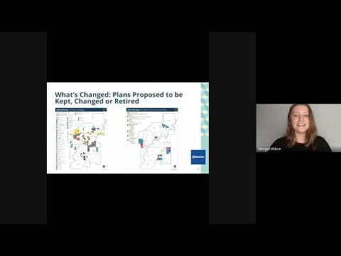
Geographic Plans Proposed to Keep, Change or Retire
As part of drafting district plans, the project team has reviewed existing strategies and geographic plans to understand if they conflict with The City Plan or if they are still needed to guide development. Based on this review, and informed by feedback we received in previous phases of engagement, the project team is recommending geographic plans to keep, change or retire.
Future Work Priorities
District plans will continue to change as future planning work happens across Edmonton. The district plans today will set the foundation for planning and engagement work in the future. More planning direction will be required in order to achieve the phased targets in The City Plan.
Through public and internal engagement, the District Planning project is also identifying areas for future work the City should undertake following the project’s completion. Future work can include ideas such as incorporating climate adaptation and energy transition strategies into district plans or identifying more heritage and cultural places in a district
This list of prioritized future work opportunities will be presented to City Council in 2024.
How to Get Involved
In this phase of engagement, we want to know more about your thoughts on the revised draft district plans and changes to the List of Geographic Proposed to Keep, Change or Retire. Your input will be used to help the City finalize the draft district plans, list of geographic plans proposed to keep, change or repeal and identify areas for future work opportunities to follow after the district plan adoption (pending City Council approval).
Share your thoughts from October 23 until December 3 using the tools below.
 |
| Learn more about the project Find out more about the district planning project, the City planning process and more. |
 |
| Find Your Geographic Plan - Map Tool Use the map tool to find your local geographic plan, and tell us what you think about the proposed retirement or amendment (change) to the existing plans. |
 |
| Surveys on District Planning Share with the City your feedback on: |
 |
|
Public Engagement Sessions
Members of the public are invited to join staff from the District Planning project to learn more about the draft district plans, what it means for your neighbourhood and to share your thoughts on the project. Online Sessions
Sign up now to participate in an online session: - Wednesday, October 25: 6:30 pm to 8:00 pm
- Thursday, October 26: noon to 12:55 pm
- Tuesday, November 7: 8:30 pm to 10:00 pm
- Thursday, November 16: 7:00 pm to 8:30 pm
Save the Date: In-Person Drop-In Sessions
Find an in-person drop-in engagement event happening near you, RSVP here to attend. - Monday, November 27: 5 to 8 p.m. at the Bellevue Community Hall (7308 112 Ave NW)
- Tuesday, November 28: 5 to 8 p.m. at the West Jasper Place Community Hall (9620 152 St NW)
- Wednesday, November 29: 6 to 8:30 p.m. at Inglewood School (11515 127 St NW)
- Thursday, November 30: 5 to 8 p.m. at Queen Alexandra Community League Hall (10425 University Avenue)
- Saturday, December 2: 11 a.m. to 2 p.m. at City Hall in the Heritage Room (1 Sir Winston Churchill Square)
|
 |
| Geographic Plans Proposed to Keep, Change or Retire Engagement Sessions Attend a virtual engagement session about the changes made to the List of Geographic Plans Proposed to Keep, Change or Retire since 2022. These sessions offer affected communities and members of the public the opportunity to share feedback on their neighbourhood-specific plan. Sign up for a session now. |
 |
| Questions (Q&A Tool) Ask a question to the project team using the Engaged Edmonton Q&A Tool below. Questions will be captured as part of engagement feedback. |
 |
| Chat with a Planner Chat one-on-one with a District Planning project team member over the phone, in-person or via Google Meet about your feedback or questions related to the project. Schedule your session now. |
Engagement on the District Planning project has concluded. This page was used for the final phase (Phase 3) of a multi-year engagement process and is now closed. Please visit our project website for more information on the project and next steps.
About the Project
District Planning is about changing the way Edmonton plans and supports development and growth to move us closer to The City Plan’s vision for a more connected, prosperous, healthy and climate-resilient city of 2 million people.
Deliberate change is required. The District Planning project will support one of The City Plan’s transformative priorities of making Edmonton a Community of Communities where residents can meet most of their daily needs within a 15-minute walk, roll or transit trip from their homes. The District Planning project is not about restricting movement, monitoring people or tracking an individual’s carbon emissions.
District Policy and Plans
The District Planning project is developing 2 new planning tools to guide how 15 districts (collections of neighbourhoods) will redevelop and change as Edmonton reaches its next population milestone of 1.25 million people:
- District Policy: provides policies that apply across all districts and other planning directions like urban design, energy transition and climate adaptation.
- 15 district plans: contain district-specific context, area-specific policies and maps showing how the citywide District Policy directions are applied in a particular district
District plans will guide the long-term physical change of Edmonton’s neighbourhoods. Your district plan will say where taller and denser buildings should go and where the City needs to invest to support growth.
Visit edmonton.ca/districtplans to check out the draft District Policy and draft district plans today.
Geographic Plans Proposed to Keep, Change or Retire
As part of drafting district plans, the project team has reviewed existing strategies and geographic plans to understand if they conflict with The City Plan or if they are still needed to guide development. Based on this review, and informed by feedback we received in previous phases of engagement, the project team is recommending geographic plans to keep, change or retire.
Future Work Priorities
District plans will continue to change as future planning work happens across Edmonton. The district plans today will set the foundation for planning and engagement work in the future. More planning direction will be required in order to achieve the phased targets in The City Plan.
Through public and internal engagement, the District Planning project is also identifying areas for future work the City should undertake following the project’s completion. Future work can include ideas such as incorporating climate adaptation and energy transition strategies into district plans or identifying more heritage and cultural places in a district
This list of prioritized future work opportunities will be presented to City Council in 2024.
How to Get Involved
In this phase of engagement, we want to know more about your thoughts on the revised draft district plans and changes to the List of Geographic Proposed to Keep, Change or Retire. Your input will be used to help the City finalize the draft district plans, list of geographic plans proposed to keep, change or repeal and identify areas for future work opportunities to follow after the district plan adoption (pending City Council approval).
Share your thoughts from October 23 until December 3 using the tools below.
|
| Learn more about the project Find out more about the district planning project, the City planning process and more. |
|
| Find Your Geographic Plan - Map Tool Use the map tool to find your local geographic plan, and tell us what you think about the proposed retirement or amendment (change) to the existing plans. |
|
| Surveys on District Planning Share with the City your feedback on: |
|
|
Public Engagement Sessions
Members of the public are invited to join staff from the District Planning project to learn more about the draft district plans, what it means for your neighbourhood and to share your thoughts on the project. Online Sessions
Sign up now to participate in an online session: - Wednesday, October 25: 6:30 pm to 8:00 pm
- Thursday, October 26: noon to 12:55 pm
- Tuesday, November 7: 8:30 pm to 10:00 pm
- Thursday, November 16: 7:00 pm to 8:30 pm
Save the Date: In-Person Drop-In Sessions
Find an in-person drop-in engagement event happening near you, RSVP here to attend. - Monday, November 27: 5 to 8 p.m. at the Bellevue Community Hall (7308 112 Ave NW)
- Tuesday, November 28: 5 to 8 p.m. at the West Jasper Place Community Hall (9620 152 St NW)
- Wednesday, November 29: 6 to 8:30 p.m. at Inglewood School (11515 127 St NW)
- Thursday, November 30: 5 to 8 p.m. at Queen Alexandra Community League Hall (10425 University Avenue)
- Saturday, December 2: 11 a.m. to 2 p.m. at City Hall in the Heritage Room (1 Sir Winston Churchill Square)
|
|
| Geographic Plans Proposed to Keep, Change or Retire Engagement Sessions Attend a virtual engagement session about the changes made to the List of Geographic Plans Proposed to Keep, Change or Retire since 2022. These sessions offer affected communities and members of the public the opportunity to share feedback on their neighbourhood-specific plan. Sign up for a session now. |
|
| Questions (Q&A Tool) Ask a question to the project team using the Engaged Edmonton Q&A Tool below. Questions will be captured as part of engagement feedback. |
|
| Chat with a Planner Chat one-on-one with a District Planning project team member over the phone, in-person or via Google Meet about your feedback or questions related to the project. Schedule your session now. |